Storyboard: Science at DMI’s Geophysical Facility: Inglefield Bredning, NW Greenland
PolarRES: more than computer coding
PolarRES is a project that is building a group of climate model simulations, known as an ensemble. This means we spend a lot of time developing and running computer code. However, we need to know that our models are capable of representing reality. In this story, we describe a fieldtrip to northern Greenland, where PolarRES partners DMI have been running a long-standing monitoring of a high Arctic fjord and the land surrounding it.
For more information on editing stories, see this blog post.


A field laboratory for monitoring changes and testing models
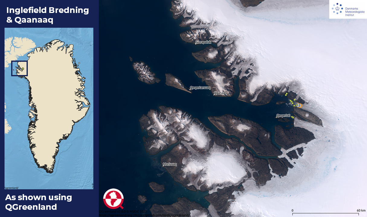
The large fjord is known as Inglefield Bredning or Kangerlussuaq (there are several places with this name in Greenland). The region is used here as a field laboratory, allowing us to not only measure climate and other environmental changes as they happen, but also as a test site where we can compare our models with reality to make sure they work.
For more information on editing stories, see this blog post.

Working together with the local Community
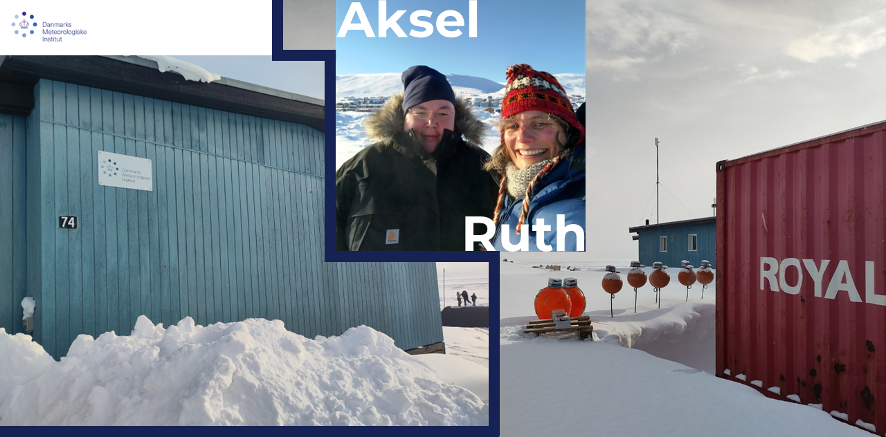
We work closely with the local community in this region. Our field station is managed by Aksel, who is from the village of Qaanaaq. The main local source of employment is fishing, for halibut and hunting, for seal, reindeer, narwhal and walrus. DMI scientists travel out into the field with local hunters. Their knowledge of the snow and sea ice conditions, the weather and how to camp out overnight is unparalleled.
For more information on editing stories, see this blog post.

Ocean and Sea ice Observations
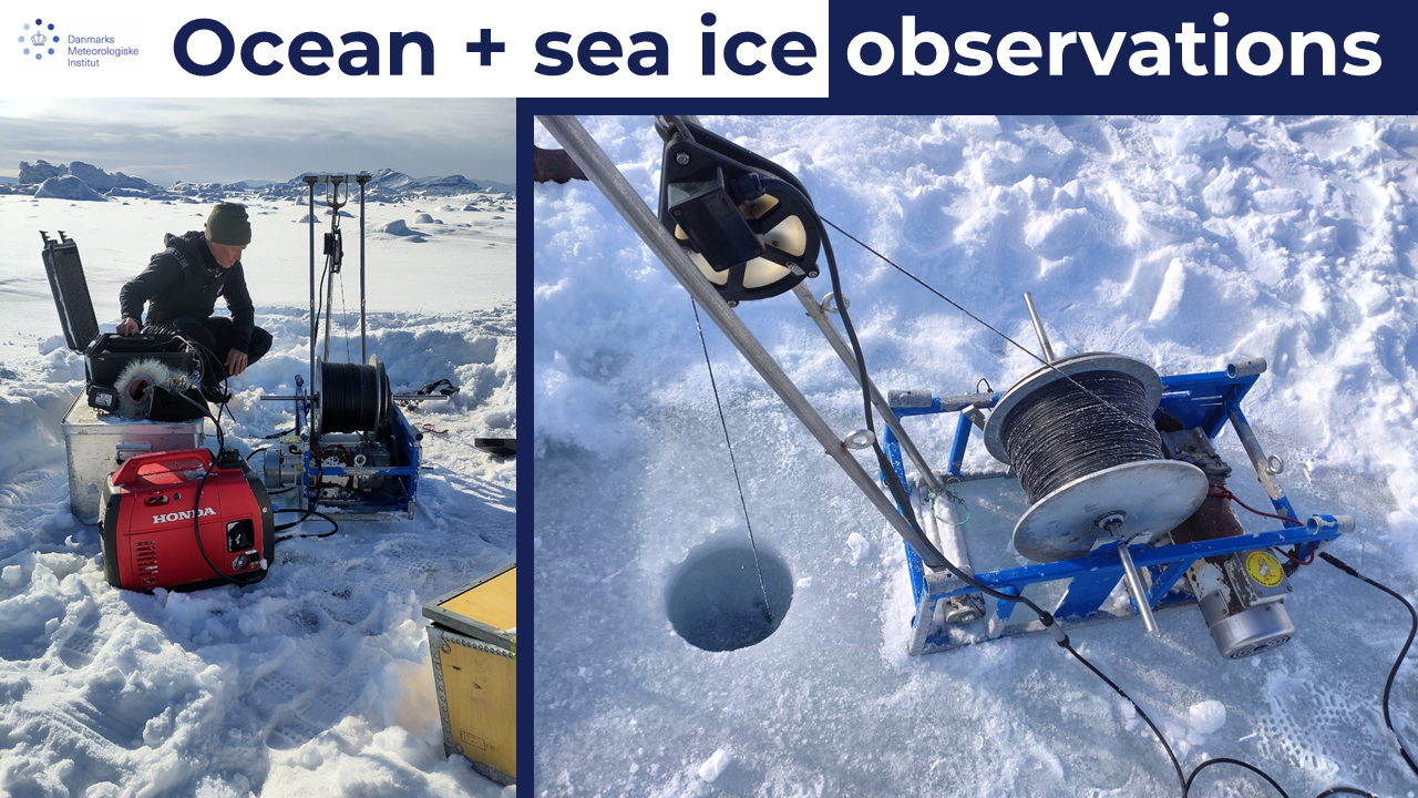
The observations include standard weather stations as well as observations in the fjord of water temperature, salinity and biological activity. For the last 3 years, there has been a focus on the properties of the Arctic snow pack. DMI have been measuring the depth, temperature and density of the snow pack on land, on sea ice and on the glaciers in the region.
For more information on editing stories, see this blog post.

Lots of data
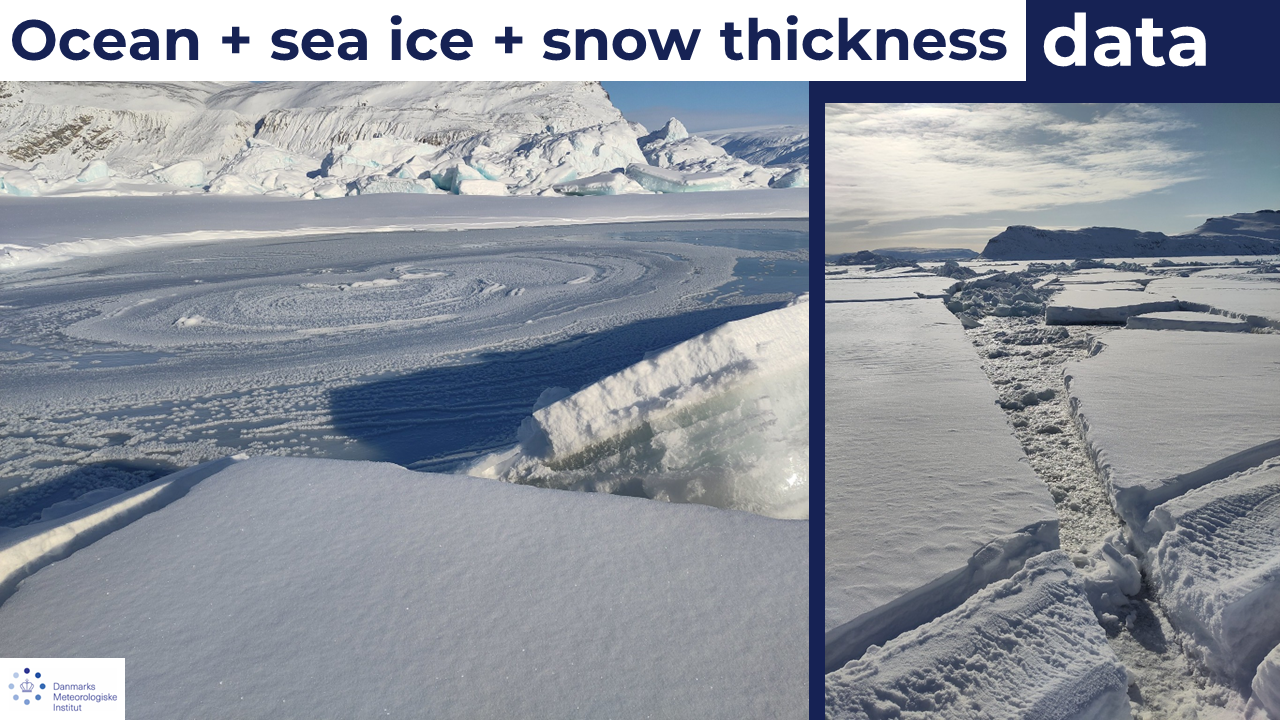
Fourteen years of data on ocean, sea ice, and snow thickness, including snapshots and wintertime time series. Together with data from other sites in Greenland, we have gathered a large amount of information we can use to evaluate the output of our climate models.
For more information on editing stories, see this blog post.

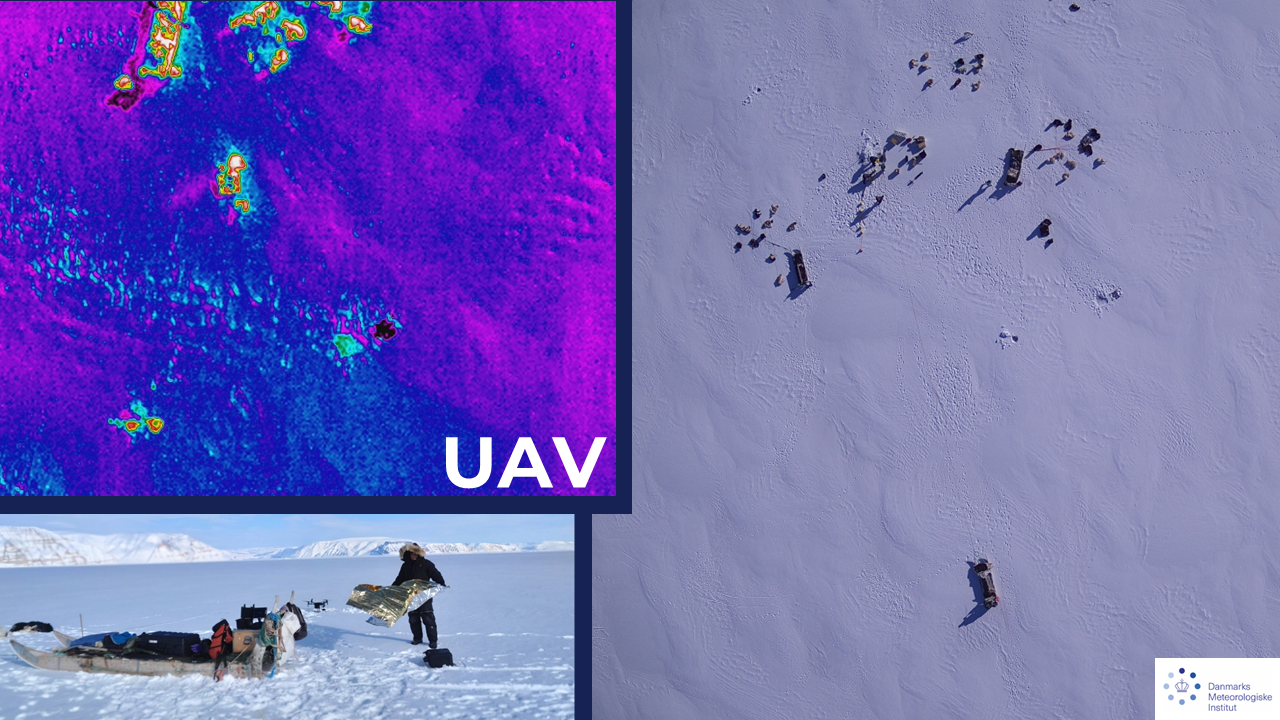
UAV Measurements
We have also been flying an uncrewed aerial vehicle (UAV) to measure surface temperatures over a wider area. Here you can see UAV measurements of surface temperature, the white spots are people, dogs and equipment. The black spot in the middle is the bright reflector we use as a control point. Surface temperature is not the same as air temperature. It is the total of all the sources of energy in an infinitesimally thin layer at the surface.
Climate models sum up all the energy fluxes- incoming solar energy, the energy emitted by the atmosphere, the energy from the air temperature, as well as the energy that comes from deeper in the ground or snow below. The UAV measures only the very surface and thats what we use to test if our models have the right weather in them.
For more information on editing stories, see this blog post.

Do you want to dig a snow pit?
The equipment you’ll need is shown here. This is snow on sea ice and it’s not very deep, only around 10 cm deep. But it is nevertheless important, because the snow acts as a very effective insulation layer, preventing the formation of sea ice (which grows from the top, because the sea below is much warmer).
The air temperature is about -19C in this photo, at the bottom of the snow on top of the ice it was only -5C. The sea ice is around a metre thick and the ocean water beneath it around +3C.
Getting the snow depth right in our models is extremely important for all kinds of Arctic processes, including the growth of sea ice, local air temperatures, the permafrost and the survival of vegetation underneath the snow.
For more information on editing stories, see this blog post.


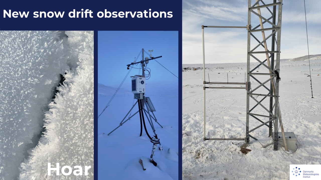
Surface hoar crystals
These are surface hoar crystals - frost that forms in a very cold, still atmosphere on cold surfaces. Often, we woke up to find them newly grown overnight, but in the sun, they evaporate again. The weather station is an important part of the equipment used by scientists to evaluate how well models work. This year we added new instruments (on the far right), that measure snow drift.
For more information on editing stories, see this blog post.

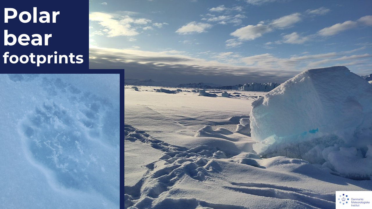
Polar bear footprints
We found them. This region has many seals, which also means there are many bears. We've never seen one during field work but our colleagues from Qaanaaq keep a good look out. These footprints were from a mother with a young cub.
For more information on editing stories, see this blog post.

Science in action
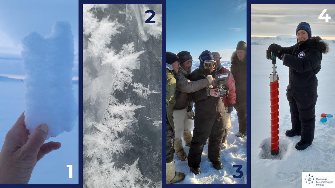
- A layer of large crystals between two layers of smaller ones. This is depth hoar, an extremely important layer that forms when cold air sits above a warmer surface.
- These are ice flowers, formed when sea water gets squeezed up on to the surface of the sea ice and then evaporates leaving salty ferny crystals behind. They are extremely beautiful and taste surprisingly salty.
- Our local hunters pointing out polar bear footprints filmed by the UAV.
- DMI colleague taking a sea ice core to measure depth and salinity of the ice.
For more information on editing stories, see this blog post.

Camp life
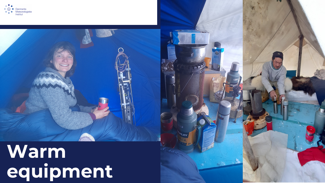
We often camp out for 2 or 3 nights, we push the sleds together and set tents up over them to create a sheltered bed. There is a stove in each tent to allow equipment to dry out overnight.
For more information on editing stories, see this blog post.


Keeping the equipment warm
We keep our scientific equipment inside the tent overnight to prevent the batteries from getting too cold. The hunters help with the fieldwork as well as camp tasks, such as melting ice for drinking water and cooking.
For more information on editing stories, see this blog post.

Different fieldwork tasks
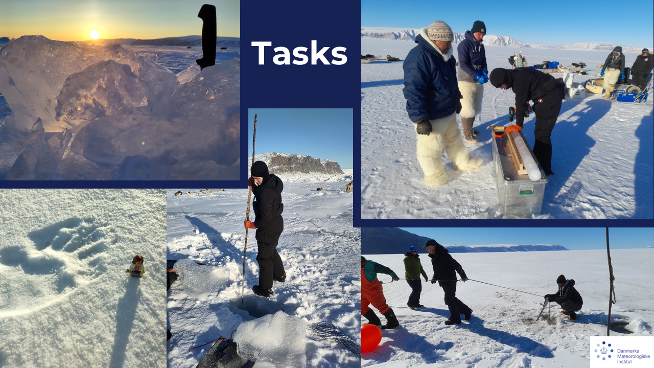
In this series you can see some of the tasks that take time in the field, a block of iceberg ice needs to be chipped apart (with the knife) to provide drinking water, a polar bear footprint is examined by a lego scientist https://icemangoeshome.wordpress.com/.
The ice spear is not for catching fish, but for clearing ice around a hole where we have been measuring carbon production in the fjord; a sea ice core is sampled for different chemicals and a mooring that has been in place all winter measuring temperature and salinity is being lifted out of the water before the ice breaks up.
For more information on editing stories, see this blog post.
